Reconstructing Antarctica’s past climates with the help of microorganisms
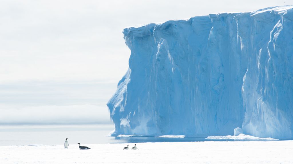
Antarctic surface lake
© Wim Vyverman
While ice cores have been able to give researchers a general idea about the global climate over the past 800,000 years, investigating certain microorganisms and their fossilised remains at the bottom of surface lakes in Antarctica can be a useful tool in investigating past climate change and variation on a more regional level and on a much shorter timescale.
This is exactly what the researchers working in the HOLANT project are doing. HOLANT falls under the umbrella of BELSPO and is a collaboration between researchers from the University of Gent and the University of Liège in Belgium as well as the British Antarctic Survey (BAS) and the Japanese National Institute for Polar Research(NIPR). Researchers who have been working in the HOLANT project and the LAQUAN project that preceded it have been using microbial communities to help them better understand how the climate in the Antarctic has varied and changed during and since the Late Quaternary (since about 30,000 years ago), and in particular since the previous interglacial period.
Dr. Wim Vyverman, aquatic ecologist at the University of Gent's Laboratory of Protistology and Aquatic Ecology spent some time with SciencePoles discussing the exciting work he and his colleagues have been doing within the HOLANT project.
How do the HOLANT project and the preceding LAQUAN project fit into the broader scheme of studying climate variation and change?
The goal of the LAQUAN project, which ended in 2005, was to gain a better understanding of the environmental history of the Late Quaternary, and the biodiversity of microbial communities living in coastal Antarctic lakes. We developed and refined new methods to study the fossil remains of microbial communities in lake sediment cores from coastal surface lakes in Antarctica and compared and interpreted the observed changes with reference data we obtained from modern microbial communities in these lakes. In the LAQUAN project, we focused on lakes in the Larsemann Hills in East Antarctica and Alexander Island. In the successor HOLANT project, we've extended the area of study to maritime Antarctica, central Antarctica, in the area of the Japanese Syowa research station (in the Lützow Holm Bay region) and also in a few isolated places in continental Antarctica.
Our goal has been to apply the models we developed during the LAQUAN project, to a network of well-dated sediment cores and compare them with the records that researchers have been getting from drilling ice and marine sediment cores. These include recently drilled ice cores from the Central Plateau, the Antarctic Peninsula and the coastal regions of Antarctica. Having a solid network of sediment core data will enable us to improve the accuracy of existing reconstructions of climate variation and change in the Antarctic since the last glacial period.
To put the kind of work we're doing into perspective, the ice cores that have been taken from the Antarctic and Greenland Ice sheets have given the scientific community a very general idea of the local climate history and the global concentration of greenhouse gasses over very large time scales (hundreds of thousands of years). This is very important information. However what's less known is how climate has evolved regionally on a much smaller geographic scale. We know much less about how climate has been evolving locally within Antarctica itself, and this has been the main goal of the HOLANT and LAQUAN projects.
Just think of the climate dynamics in Belgium and the Netherlands for example. They are very different from the climate dynamics in Italy or Greece, even though all four countries are on the same continent. In the Antarctic we similarly need to have a network of reconstructions of climate behaviour and particularly in the coastal regions in order to assist climate modellers in coming up with more precise predictions on how the climate is changing and how it's going to change in the future. You can't get this kind of information from ice cores alone, as regions suitable for ice core drilling are in most cases situated on the central plateau. You therefore need other records which extend this network, so we're concentrating on those regions in the Antarctic where paleoclimate records are sparse, particularly in the coastal areas.
In fact the research we've been doing also contributes to a broader project within the IGBP (International Geosphere Biosphere Programme), the Pole-Equator-Pole traverses being studied under the PAGES Project, which is trying to establish a good climatic record along several north-south transects around the world. There's one transect running from the North American Arctic to the tip of South America, another running from Scandinavia through South Africa, and another one going from Asia through to Australia and New Zealand. This initiative will supply the kinds of regional information on climate change that's needed to build higher resolution models of climate behaviour. People have been doing this kind of research in the Northern Hemisphere for a long time, but in the Southern Hemisphere there is a lack of data. So with the HOLANT and LAQUAN projects and the other international projects we've been cooperating with in this domain, we're trying to do our part in Antarctica.
How is it that you can learn about climate variation and change by looking at microorganisms living at the bottom of Antarctic lakes?
The bulk of the biological activity in many Antarctic lakes is carried out by microorganisms such as cyanobacteria and diatoms. These microorganisms respond to changes in the lake environment which in turn is determined by climatic changes. Hence, fossil microorganisms and their remains such as pigments, which are stored in lake sediments, reflect how climate has changed in the region where lakes are located.
So by looking at the composition of the microbial communities currently living in these lakes and comparing them to what we can understand about microbial communities from long ago based on microfossils and their chemical remains taken from sediment cores, we have been able to come up with models that reconstruct environmental conditions in the region around these lakes going back thousands of years to the previous interglacial period. We've been able to determine things such as moisture and salinity levels, as well as light and ultraviolet radiation levels. We've also been able to develop relative sea level curves (which are a function of ice sheet thickness and global sea level) for the Larsemann Hills region of Antarctica, which basically means we have been able to determine past sea level changes.
How deep are these lakes? Are they perpetually covered in ice?
The average depth of the lakes we've been studying ranges between 10 and 40 metres, although there are some that are as shallow as 3 metres. The water usually freezes to a depth of 2.5 metres, however many lakes can unfreeze during the summer months. It depends. In some areas, the lakes might retain their ice cover, while in other areas the ice might only melt around the edges. There's also a lot of variation in the ice cover of these lakes from year to year.
How do you go about getting the samples you need to get information on past and present microbial communities in these lakes?
We normally take one sediment core from the deepest part of each lake we're studying. We also take a number of other samples. We sample the water column to look at water chemistry and the biological communities living in the water column, and we also sample the living communities on the top of the sediment layer at the bottom of the lake at several different places in the lake.
All this information helps us interpret the limnology of the lake and the kind of flora we can encounter in the lake. We use modern-day samples to relate the distribution of individual species to physical and chemical conditions in the lakes. We do this by constructing what we call transfer models, which we can then apply to fossil data. Transfer models allow us to reconstruct the salinity of the lake for example, which gives you an idea of the evaporation- precipitation balance in the region (more precipitation means lower salinity of the lake),
Why are diatoms and cyanobacteria of particular importance in understanding how environmental conditions have changed over time?
It's quite simple. In the Antarctic cyanobacteria and diatoms are the permanent primary producers, which means they are at the bottom of the food chain. Primary producers are usually the most susceptible to any changes in things like temperature, water salinity, and so on. So by looking at changes in primary producers, we can determine what kind of environmental changes might have taken place in the past.
Diatoms and cyanobacteria are the most important indicator organisms we've got in the Antarctic, since they accumulate in Antarctic lake sediments over time. Diatoms are particularly interesting because they fossilise easily, and have silicified skeletons that can be preserved for thousands of years after they die. Cyanobacteria provide us with interesting pigments that we can use for example to look at the variation in levels of Ultra Violet radiation within the water column. The pigments also give us an idea of how much biomass was produced over a certain period of time. As biomass production in some Antarctic lakes is related to temperature, which also gives us an idea about past climate variability.
In the official report at the end of the LAQUAN project, it mentions that you found a lot of species of microorganisms to be endemic to certain regions of Antarctica. Why is this of such importance?
By examining the biodiversity in the lakes of a region you can get to know the genetic relationships between the different species occurring within the same area and those occurring in other Antarctic regions. Then you can use this information to get an idea about the time span that a particular kind of flora has existed. So if we find endemic populations that have been in a particular region for a very long time - long enough to be genetically different for other populations elsewhere - then this is very good evidence that the particular habitat has been there for a very long time. And this is information that glaciologists can use to get a better picture of how ice sheets have evolved over time.
You'd be able to tell when a certain area became covered with ice, how long that area has been covered with ice, whether it has ever been a freshwater habitat and how long these conditions lasted (or have lasted), and how this permitted the evolution of biota in particular regions.
When you take a sediment core, how far back in time can you go?
This depends on the kind of lake we're dealing with. It also depends on how fast sediment accumulates in a lake. We most commonly find sediment cores going back about 11,000 years. During the LAQUAN project, however, we obtained sediment cores that by our best estimates must be on the order of between 50,000 and 130,000 years old. This is the furthest back in time we've been able to go with the lake sediment cores we've taken so far.
How are you able to know the relative sea level of a region from the sediment cores in these lakes?
What we do is we look in the sediment cores for transitions between marine sediments and freshwater sediments in isolation lakes. Isolation lakes get their name from the fact that they used to be below sea level and were thus part of the sea - in this case part of the Southern Ocean. Due to the uplift of the continent that occurs as the ice sheet melts and the mass weighing down on it decreases - which normally happens during interglacial periods and is called isostatic rebound - these lakes eventually become isolated from the sea. Once this happens one of two things can occur. You can either have a regular flow of freshwater into the lakes that would slowly dilute the saltwater over time until the lake is completely filled with freshwater, or, if the lake is located in a particularly dry area with very little precipitation, then the lake water becomes more and more saline over time, and the lake becomes hypersaline.
In freshwater lakes, you can very easily see from these transition zones in fossil deposits. Dating these transition zones then tells you when they became freshwater lakes, which happened not very long after they became isolated from the sea.
Then you need to look at absolute sea level change. Sea level fluctuated over amplitudes of 100-120 metres globally during the last series of interglacial cycles. During glacial periods there is more water stored in ice caps. At times during interglacials, we have a situation like what's happening now - the ice rapidly melts and sea level rises everywhere around the world. By comparing the timing of the emergence of these isolation lakes from the sea to the absolute sea level at the time, this gives us an idea of the relative sea level changes that took place.
These relative sea level changes tell us a lot about how the ice caps behaved in particular regions, because the ice does not melt everywhere at the same rate and to the same extent. This is something useful to glaciologists modelling how the ice cap over Antarctica has been evolving over time, and for that they need good data. So far ice sheet models have been quite simple. Glaciologists have divided Antarctica into different sectors, and they assume that each sector behaved more or less in the same way. But better, more refined models need to be made. Relative sea level curves are important in doing this because they tell glaciologists how the ice cap has behaved locally on a much smaller geographic scale since the warming period began after the last glacial maximum.
So what can you say about the past climate of the regions you've studied so far?
Well, take for example the Larsemann Hills region. We've found from sediment cores taken in this region that during the previous interglacial it was much warmer there than it is today. We know this because we found traces of organisms in the sediment core dating from the previous interglacial that can currently only be found in sub-Antarctic regions of the planet. The zones in which these microorganisms can live shift towards the poles when the climate becomes milder and back towards the lower latitudes when the climate becomes cooler. Finding particular diatoms in sediment cores in the Larsemann Hills that you normally only find in places like the Kerguelen Archipelago today means that during the last glacial maximum these microorganisms disappeared completely and have never been able to re-colonise Antarctica ever since.
Also, in contrast to what had been previously believed, it now seems that the East Antarctic Ice Sheet responded dynamically to past climate change anomalies since the last glacial period. The volume of the East Antarctic Ice Sheet probably increased during warmer events, which was likely the result of increased snowfall during the Holocene.
Furthermore, we have shown that about 2000-4000 years ago, climate over parts of Antarctica was milder than today. We are currently investigating how these warmer conditions affected life in Antarctic lakes.
How much more research will it take before you have a clear enough idea of what's been happening in terms of regional climate variation and change in Antarctica?
It's difficult to say. We have a very close collaboration with ice sheet modellers, and through our interaction with them we'll know how good our coverage is and how much we can improve their current models. This will also help us to indicate areas in which further ground investigations are needed to better support and refine models.

Wim Vyverman
Wim Vyverman is an aquatic ecologist at the University of Gent's Laboratory of Protistology and Aquatic Ecology. An expert in phytoplankton, he has used markers from phytoplankton to reocnstruct past cliamtes in Antarctica.