The giant circular scar on the King Baudouin Ice Shelf: a glaciologist’s perspective
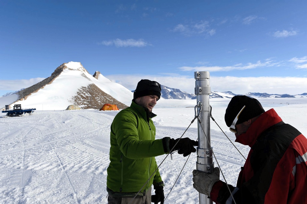
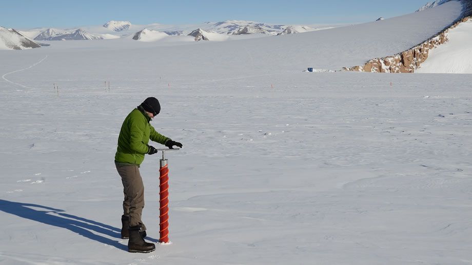
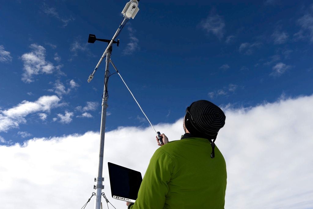
Jan Lenaerts testing the instruments on the automatic weather station on the King Baudouin Ice Shelf
© International Polar Foundation / Jos Van Hemelrijck
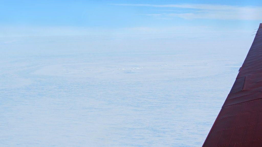
In December 2014, a team of geophysicists working for the Alfred Wegener Institute spotted a large, 2 km-wide feature in the surface of the King Baudouin Ice Shelf in East Antarctica. Their initial hypothesis was that the giant scar was brought about by a meteorite impact, which may have happened in September 2004. However once the story got out to the international media, scientists from around the globe began to weigh in on other possible explanations.
Glaciologists in particular have hypothesized that the giant feature could be an ice doline - a feature caused by surface melt water collecting in one place, refreezing on the surface, and draining into the ice sheet and ocean below.
One glaciologist who has been studying the King Baudouin Ice Shelf as part of his BENEMELT research project (funded by the InBev-Baillet Latour Antarctic Fellowship), intends to visit the circular scar on the ice shelf. Dr. Jan Lenaerts from Utrecht University plans to examine it more closely during his next Antarctic field campaign, scheduled for January and February 2016.
Dr. Lenaerts offered his explanation for what he thinks about the giant scar, and what might be happening on the ice shelf.
You were one of the first glaciologists to contact the team form the Alfred Wegener Institute who found the giant circular scar in the King Baudouin Ice Shelf to offer them an alternate hypothesis about what it could be. What is your opinion?
I’m pretty sure that the circular feature that we see on the surface of the ice shelf is an ice doline. An ice doline is the result of melt water lakes forming on the surface of the ice shelf due to surface melting. These lakes freeze over in the winter and can be covered by snow, which is why you don’t see them from the surface all the time.
However, some of the water below the surface remains liquid, even in the winter, because the snow that falls on the surface of the ice shelf insulates the layers below from the more severe temperatures on the surface.
But as the meltwater water accumulates, the water weighs down on the ice shelf, and and at some point, the lake drains into the ice shelf and possibly to the ocean below.
So that’s how an ice doline forms?
What you see if you look at this feature from above in a plane are remnants of this melt / refreeze / drainage process. If you look at satellite imagery, you can see many similar features on ice shelves in Antarctica. There are three or four just on the King Baudouin Ice Shelf. I don’t think it’s possible for this feature to be the result of an impact event.
If this feature were a result of an impact event that happened several years ago, then the feature that you see would already be filled with snow. The King Baudouin Ice Shelf is a rough place. There’s a lot of wind in winter, so there would be a lot of snow that would have filled any impact scar relatively quickly.
It’s probably an ice doline that drained a number of months ago. In any case, it’s a very intriguing find.
Why is it an intriguing find for you, as a glaciologist?
If this feature is an ice doline, then it’s indicative of surface melt on the King Baudouin Ice Shelf. At this point, I don’t know where the water comes from. But we intend to investigate that when we visit the site.
We know that ice dolines exist in abundance on ice shelves in West Antarctica. But to my knowledge, you don’t find them that often on ice shelves in East Antarctica. It’s a feature that signals that there’s a lot of surface melt going on, and you need certain conditions (such as enough summer heat for significant surface melt to occur) for them to exist. And these conditions don’t exist that often in East Antarctica.
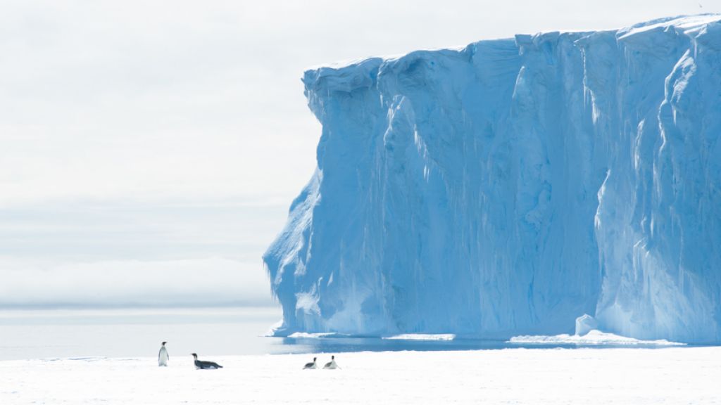
It’s interesting to see a possible ice doline close to the grounding line of the ice shelf. I set up an automatic weather station here last December during the first of two research seasons during which I’ll have a closer look at the ice shelf.
My colleagues and I are very interested in having a look at this feature in the ice and do some ice radar analysis, and perhaps take some firn cores to see if our hypothesis about this feature being an ice doline is correct. This feature is 2 km wide. A lot of surface melt would have to be going on if this is in fact an ice doline.
Why would the doline have formed where it did?
I think the doline might have formed around a topographic depression in the ice. So when melt on the surface of the ice shelf occurs, due to gravity, water collects in a depression in the ice surface. At some point, because the lake gets too big, and the weight of the water becomes too much, the water drains.
But ti would be intresting to investigate further why the water collects in that particular part of the King Baudouin Ice Shelf. This might have something to do with melt of the ice shelf coming from below the ice shelf. Bottom melt of the King Bauduoin Ice Sheet is something glaciologists Frank Pattyn Jean-Louis Tison and and their colleagues at the Université Libre de Bruxelles have been studying over the past several years in the IceCon project. There’s a possibility that one or both of them may accompany me when I go out to the ice doline next year. We’re still discussing this.
Maybe the ice shelf is a bit thinner at the location of this doline due to melting from warmer waters beneath the ice shelf? If the ice shelf is thinner in this location, it would make it easier for water to drain form the surface down below. It’s certainly worth investigating. We can go there next year with high an low-frequency radar to see how deep the ice shelf is there and what the surface layers of the ice sheet at this location look like. This will already tell us a lot more about what’s happening.
It would certainly satisfy a lot of people’s curiosity if you had a look at this circular feature in more detail.
Of course. We would like to know more about how the ice doline forms and its structure. We’ll also look at satellite data to determine how long these dolines are there, and how often they drain. Do they fill and drain over one season, or over several seasons? There are so many questions I’d like to answer.
But one thing is certain: apparently there is so much surface melt, that the meltwater doesn’t re-freeze where it melts, but flows elsewhere. This means that this region of East Antarctica is more active in than many people think.
What do you mean by “more active”?
There’s a lot more surface melt going on. It means that close to the grounding line of the King Baudouin Ice Shelf, the firn pack is rather unhealthy. It doesn’t have the capacity to re-freeze all the snow that melts on the surface, which means that the meltwater that is produced on the surface runs off to another place on the ice shelf - such as a depression - where it collects and builds up.
If climate warming continues, this melting process would only continue and reinforce itself. The more melt occurs, the more drainage of water inside the ice shelf, and the more unstable the ice shelf becomes. This my hypothesis, in any case.
By an “unhealthy” ice shelf, do you mean that the King Baudoin Ice Shelf could one day break up?
When you dig below the surface on a healthy ice shelf, you should find a lot of snow, which can contain and re-freeze a lot of the meltwater that comes form surface melting. When meltwater is produced at the surface, it should percolate downwards into the snow. But because the snow is cold, the meltwater refreezes. This is why there are ice layers at the surface of the ice shelf.
Where we set up the AWS at the grounding line of the King Baudouin Ice Shelf, if you dig 50 cm deep into the snow, you already hit very thick layers of ice, which means there’s not a lot of snow at the surface that can hold the surface meltwater. This is indicative of a lot of surface melting. As a result, surface meltwater runs off towards depressions and forms surface melt lakes, and ultimately ice dolines over the melt / refreeze / drain process.
The fact that the snowpack in the surface of the ice shelf is unhealthy, and the fact that this ind of thing is happening on an ice shelf with the ocean underneath means that the surface meltwater drains to the ocean underneath the ice shelf, which can lead to holes in the ice shelf and further instability. A lot of this kind of surface melting has been seen in West Antarctica on ice shelves before they broke up.
East Antarctica has generally been considered quite stable in terms of ice mass loss, when compared to West Antarctica, which has seen a lot of ice loss. Does this mean that East Antarctica may not be as stable as previously thought?
I’m not saying that just because the King Baudouin Ice Shelf might be bit less stable that originally thought that ice throughout East Antarctica is more unstable than the scientific community originally thought. All I’m saying is that there might be some places - like the King Baudouin Ice Shelf - where a climate exists that allows regular and prolonged surface melt to occur on the ice shelf.
What this means in a more global context will become evident as we continue our investigations.

Jan Lenaerts
Jan Lenaerts is a Belgian glaciologist with a strong background in meteorology at Utrecht University in the Netherlands interested in ice and snow in the polar regions and how they affect the global climate system. He is the 2014 laureate of the InBev-Baillet Latour Antarctica Fellowship, which has allowed him to conduct two seasons of resaerch on the King Bauduoin Ice Shelf, studying surface melt of the ice shelf under the BENEMELT project.
-

Jan Lenaerts took several firn cores to examine surface melt of the King Baudouin Ice Shelf over the past 10-15 years during the first field season of the BENEMELTproject.
© International Polar Foundation / Jos Van Hemelrijck
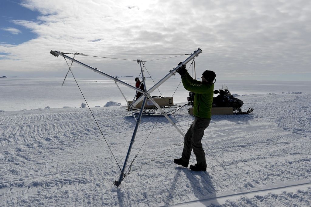
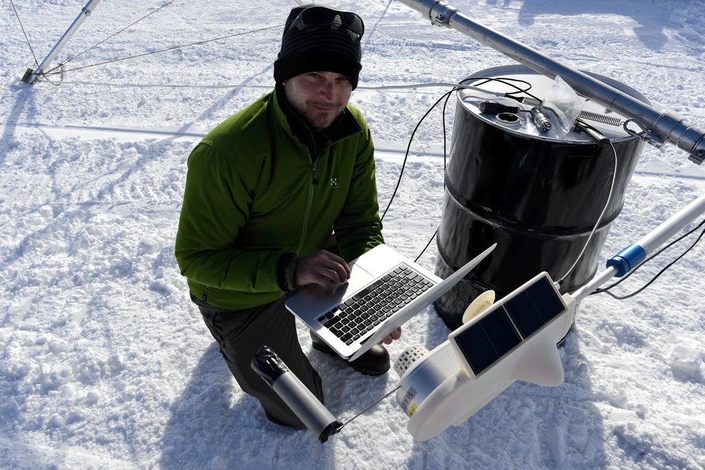
Dr. Lenaerts set up an automatic weather station on the King Baudouin Ice Shelf in December 2014. He's monitoring weather conditions on the ice shelf as part of the BENEMELT project to see how many days have conditions that favour surface melt.
© International Polar Foundation / Jos Van Hemelrijck
Testing the instruments for the automatic weather station.
© International Polar Foundation / Jos Van Hemelrijck
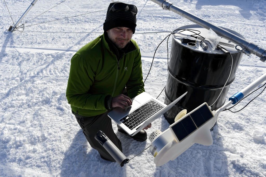
The automatic weather station transmits near real-time meteorological data from the King Baudouin Ice Shelf.
© International Polar Foundation / Jos Van Hemelrijck