Ice rises: key archives of de-glaciation history
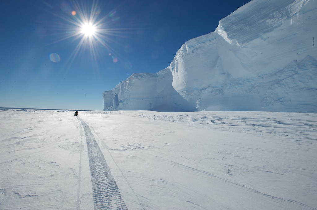
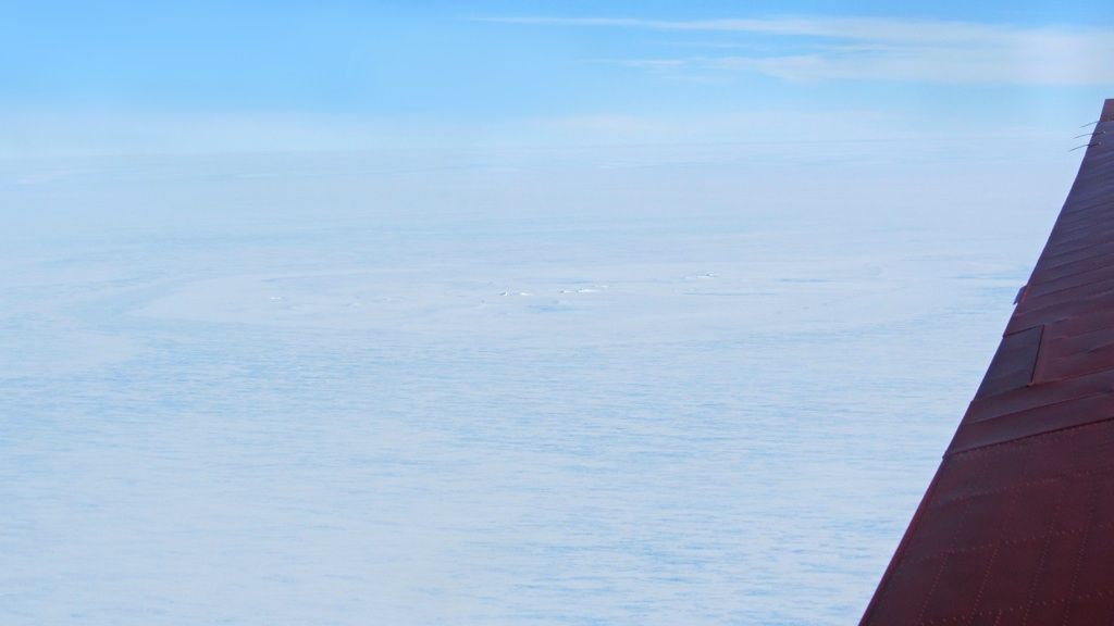
A view from the King Bauduoin Ice Shelf.
© International Polar Foundation
The ice sheet covering Antarctica slowly flows towards the coasts due to gravity, and when this ice reaches the coast it often forms floating platforms of ice called ice shelves. Floating on water, the ice continues to flow away from the continent until it reaches a point where icebergs calve off the end of it, and new ice flows in from the continent to replace the lost ice. The rate at which the ice flows determines (in part) how fast ice is lost from the continental ice sheet, which in turn has implications for global sea level rise (especially if ice is lost from the ice sheet faster than it is replaced through snowfall on the surface of the ice sheet).
However, as ice flows through the ice shelf, it can encounter islands and other bits of ocean bed that stick up from the sea floor, slowing down ice flow. The larger obstacles create ice rises - a feature that Dr Reinhard Drews from the Université Libre de Bruxelles has been studying as part of the Be:Wise project. Thanks to a 150,000 Euro grant from the InBev-Baillet Latour Antarctica Fellowship, which allowed him to take part in two field season in Antarctica (2012-13 and 2013-14), Dr. Drews has been able to study the buttressing effect of the Derwael Ice Rise on the King Baudouin Ice Shelf in East Antarctica.
However, while studying the buttressing effect of the ice rise, he and his colleagues have also been able to make a few other observations - namely what the ice rise has to tell about the de-glaciation history of that particular part of East Antarctica (Dronning Maud Land). In this interview, he explains some of the key findings of his work, published recently in the Journal of Geophysical Research: Earth Science.
How does an ice rise form exactly? How common are they? Are they very large?
An ice rise is a very common feature in ice shelves in Antarctica. It forms in an ice shelf when the otherwise freely-flowing ice encounters an obstacle that slows down the ice flow so that it becomes almost stagnant. If this is the case, a local ice mountain is formed that can be several hundreds of metres high (if it were only few tens of metres high, it would be called an ice rumple).
An ice rise has its own local flow regime. For example, the Derwael Ice Rise (the ice rise one the King Baudouin Ice Shelf, which I’ve been studying under the Be:Wise project) is several hundred metres above the surface of the King Baudouin Ice Shelf. It’s like a miniature ice cap, or an ice mountain. If you’re on the ice shelf, you can see the ice rise from quite a long distance away.
What happens to the ice as it flows over an ice rise?
On the ice rise you have very localised ice flow patterns. Because the ice rise sits on ocean bed, this creates a lot of friction between the ice and the rock, which also means that it buttresses the ice upstream.
What in particular have you been studying about the Derwael Ice Rise?
In the Be:Wise project, we’re interested in studying the buttressing effect of the Derwael Ice Rise on the ice flowing off the continent and onto the King Baudouin Ice Shelf.
However, one nice thing about ice rises is that they archive how long they have existed as local flow features. During the last glacial period (approximately 114,000 to 11,700 years ago), the ice sheet covering Antarctica probably advanced further than where it stands today - perhaps even to the continental shelf around Antarctica. When it did, it may have swallowed all of the ice rises in its path.
But after the last ice age ended and the Holocene (the current interglacial period starting 11,700 years ago) began, the ice sheet started to retreat, and ice rises were exposed again as the ice sheet retreated.
Since ice rises record how long they have existed as an independent feature, this can tell us approximately by when the ice sheet had retreated inland from the ice rise.
How exactly does an ice rise record how long it has existed?
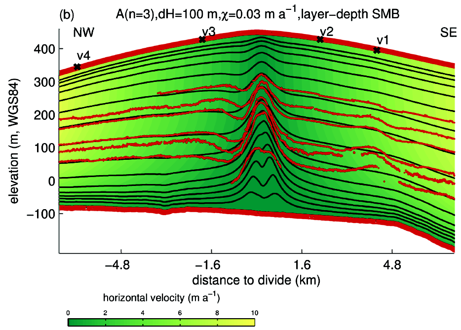
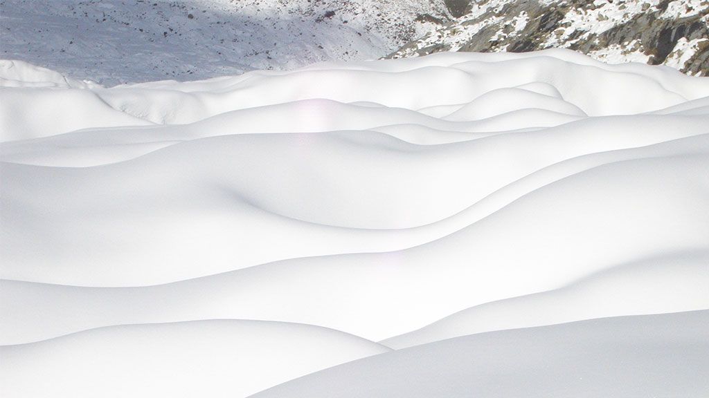
There’s something in glaciology called the Raymond Effect, in which the ice stratigraphy beneath topographic divides (ice divides) creates large bumps . From ice radar measurements, you can see the bumps in the internal stratigraphy of the ice rise (Figure 3 in the paper gives a very prominent example).
These bumps start to form as soon as the ice rise exists as an independent feature and a local ice flow pattern becomes established around the ice rise. The longer the ice rise has been around, the bigger the bumps become. So from the height of the bumps in the ice radar images we took, we can tell how long an ice rise has existed.
How do you know when the first bumps evolved?
First of all, we measure the bumps in the ice layers using an ice radar. There’s no other way of visualising these kinds of bumps without using radar, which means you need to be on-site in Antarctica to study the ice rise. You also need to collect GPS measurements to see how fast the ice is flowing. But the most essential data you need is from the ice radar, because the radar tells us how big the bumps are.
We then input this data into a sophisticated computer ice-flow model that can reproduce these bumps in the ice, and investigate different scenarios with the model. For example, we assume that the ice rise started to exist as an independent feature at different times in the past - 3,000, 5,000, 10,000 years ago - and then we run the model forward in time to the present day. Then we see which run of the model best reproduces what we see today on the ice rise.
If the model doesn’t reproduce what we see today, we go back and change the parameters, including since when the ice rise has existed, and run the model again. We have to do this many many times until we get a result that matches what we see today on the ice rise.
So how long has the Derwael Ice Rise existed, according to your model?
We can say that the flow patterns around the Derwael Ice Rise have existed for at least 5,000 years, meaning that the ice rise as an independent feature has existed for at least that long. This means that the Antarctic Ice Sheet was no longer covering Derwael Ice Rise during that period. This is the main finding of our research paper.
But keep in mind that 5,000 years ago is a lower boundary - which means the ice rise could have existed independently even before then. But from our methodology, we’re only able to determine that the Derwael Ice Rise is at least 5,000 years old.
Collecting rocks and measuring how long they have been exposed at the surface would be another way to understand the deglaciation history. How did you use this information in your study?
There is data using exposure dating from the Sør Rondande Mountains and Lützow-Holm Bay collected by Japanese geomorphologists in other studies. Our findings are broadly in line with their results. However, those areas are many hundreds of kilometers away from our study site.
This shows why ice rises are important features to study to determine ice sheet retreat. There are no rocks in the coastal area where the King Baudouin Ice Shelf is that you can study to see how long they’ve been exposed at the surface and thus free of ice cover. You need to go inland 200 km to the Princess Elisabeth station to find any exposed rocks in the Dronning Maud Land region of East Antarctica. The only features we have at the coast that can tell us about ice sheet retreat are ice rises.
For example, my colleague Lionel Favier is currently using a model to reconstruct the geometry of the East Antarctic Ice Sheet in the Dronning Maud Land from the last glacial period to today. This is part of the IceCon project my glaciologist colleagues at the Université Libre de Bruxelles are working on. For him, it’s important to know whether the ice sheet ever covered the Derwael Ice Rise. From the research we did in the Be:Wise project, we can say that it didn’t for at least the last 5,000 years (and probably for longer).
His modelling results should be consistent with ours, meaning that his model can’t produce a situation where the Derwael Ice Rise only started to exist 500 years ago, for example. Otherwise, the model would not be dependable, especially if you want it to predict what will happen to the ice sheet in the future. It’s important to understand history in order to understand what will happen in the future. This is why we create these kinds of models.
What is the name of the model you use in the study?
It’s called Elmer/Ice. This is the most sophisticated model on the market because it does very little approximations in the physical equations. This is required when modeling the Raymond effect because all stress components are important. You can’t ignore certain parameters (like neglecting a few terms in the force balance equations) in order to simplify the model. That’s acceptable if you’re modelling on a larger scale, but it’s not if you’re trying to do the kinds of detailed analyses that we’re doing.
Another thing about this model is that it’s very high-resolution, meaning you can map what’s happening down to a 40 metre x 15 metre grid - which is very tight for a model of ice behaviour.
How would you link these very precise models describing a comparatively small ice rise with models describing the entire Antarctic ice sheet?
I think the best way to go about it is to use these kinds of sophisticated models for targeted studies. So for an area like the Derwael Ice Rise, you need to have a complex model incorporating all the physics and at high resolution in order to understand what’s going on. Then, once we know what’s going on, we could use simpler versions of the processes involved and incorporate them into the less complex and more large-scale models.
How many ice rises have been studied as in-depth as the Derwael Ice Rise?
Not very many have been investigated so far compared to the number of ice rises there are on the continent of Antarctica.
I can tell you that in the Dronning Maud Land in East Antarctica, only two have been investigated in detail. Our Norwegian colleagues are also looking at a number of ice rises in East Antarctica, but there is still loads of work to be done.
Why have so few ice rises been studied?
The reason so few ice rises have been studied has to do with logistics. It’s not easy to get to to them and study them. We’re fortunate that we can reach Derwael Ice Rise from the Princess Elisabeth station so we can spend enough time to do thorough research on it.
It’s important to study more than one ice rise to see if one tells us one thing and another one tells us something different. The more we know about what’s happening on different ice rises, the more we know about the de-glaciation history of Antarctica. This knowledge is needed for reliable predictions of the future.

Reinhard Drews
Reinhard Drews is a postdoctoral researcher at the Glaciology Laboratory at the Université Libre de Bruxelles interested in studying ice flow characteristics in the coastal region of eastern Dronning Maud Land in East Antarctica, where the marine ice sheet is buttressed by numerous ice rises. Dr. Drews was awarded the 2012 InBev-Baillet Latour Antarctic Fellowship to conduct research on the King Baudouin Ice Shelf under the Be:Wise project.
-

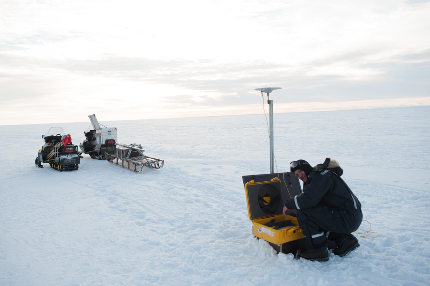
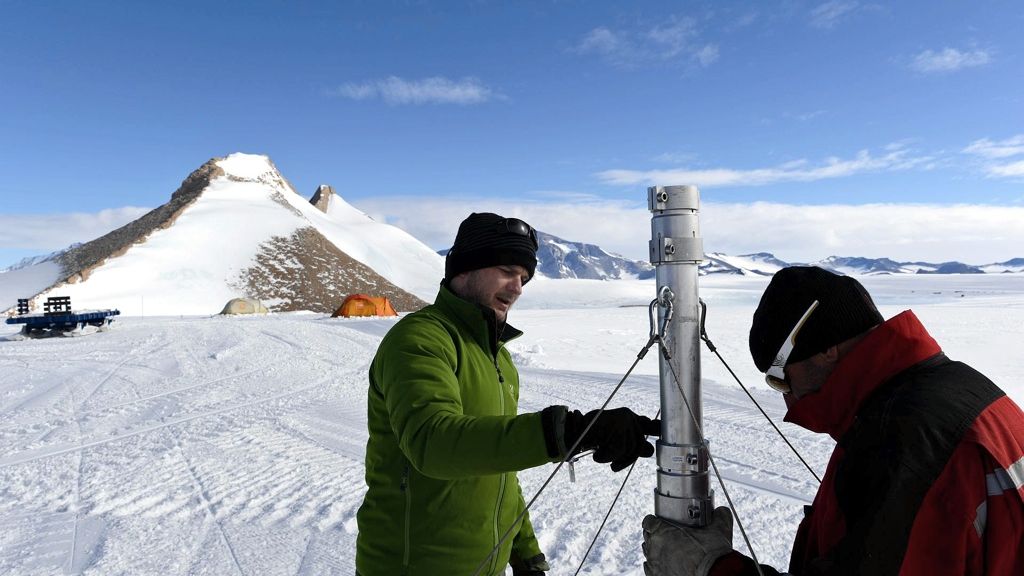
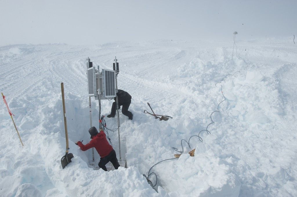
Glaciologist and InBev-Baillet Latour Antarctic Fellowship recipient Reinhard Drews installing a GPS station on the King Baudoin ice shelf as part of the Be:Wise scientific project.
© International Polar Foundation
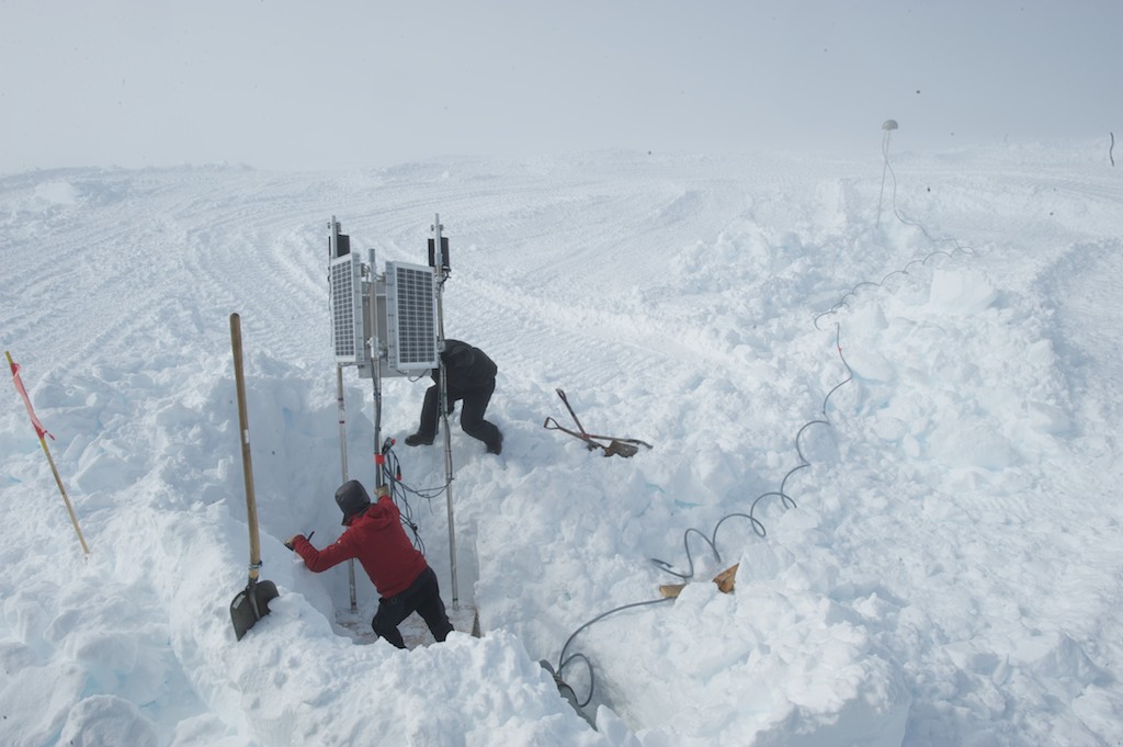
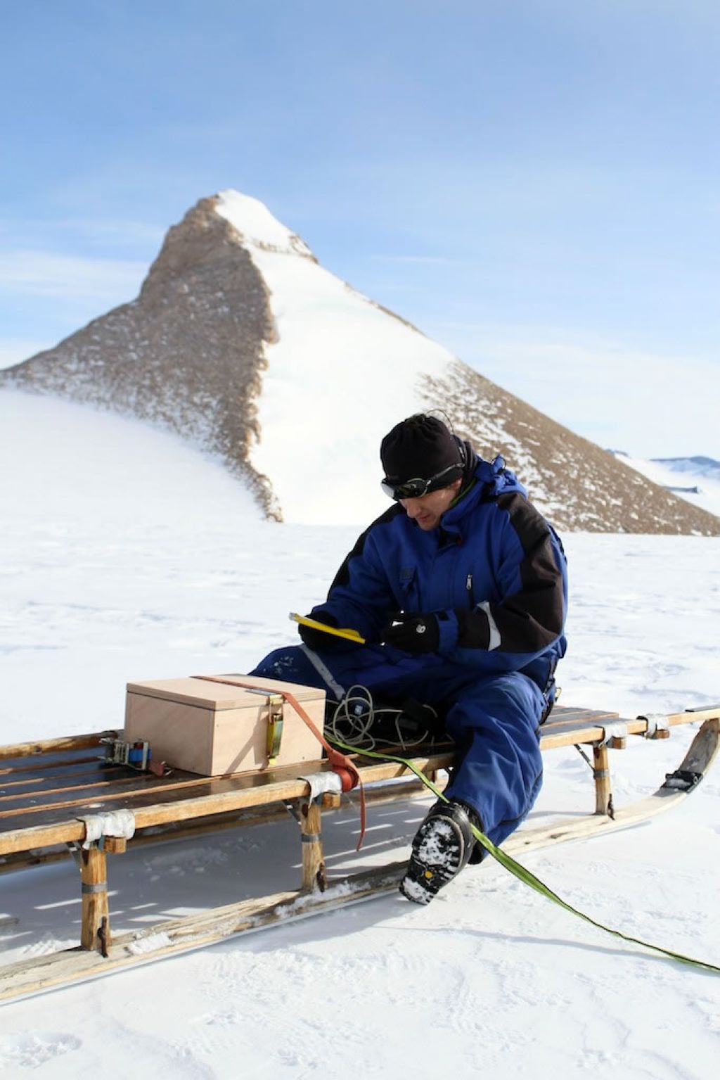
Maintaining a GPS station on Derwael Ice Rise.
© International Polar Foundation
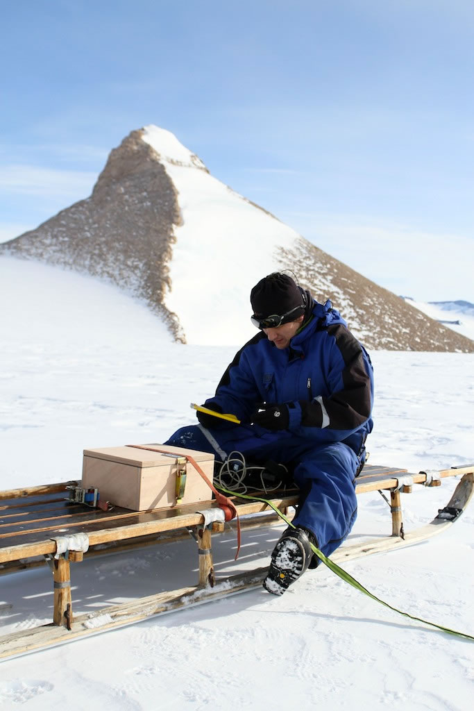
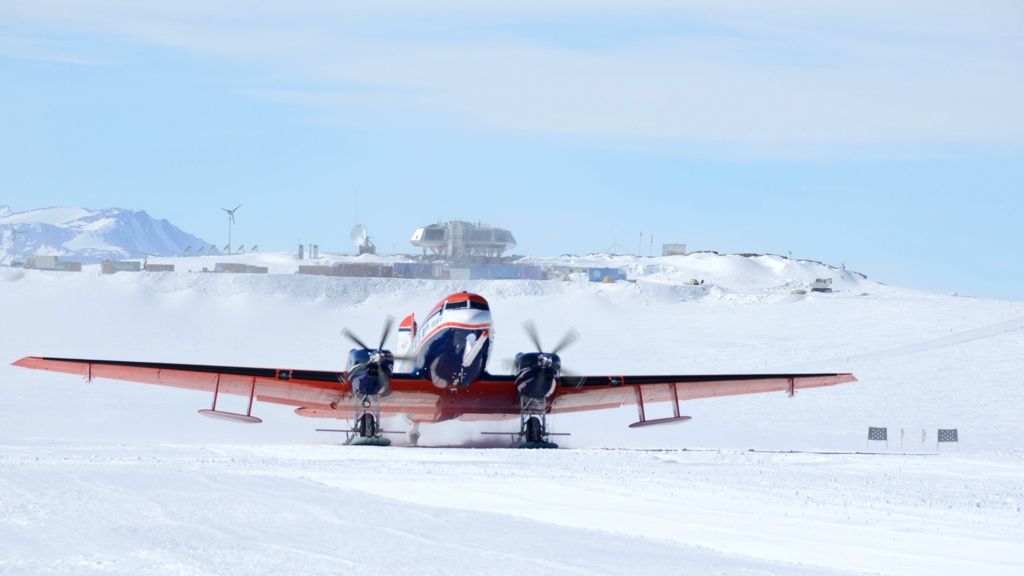
Reinhard Drews preparing his interments prior to heading out to the King Baudouin Ice Shelf.
© International Polar Foundation
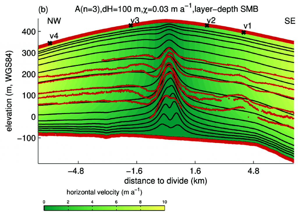
Ice radar imaging reveals a large bump in the ice flow above the Derwael Ice Rise.
© Reinhard Drews