The Thwaites Glacier and using UAVs for glacier research in Antarctica
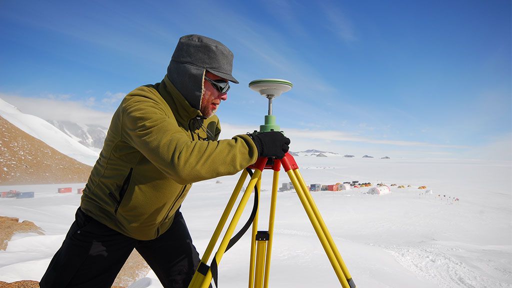
Dr. Anandakrishnan monitoring a glacial quake
© Sridhar Anandakrishnan
A leading expert on the ice streams of West Antarctica, Dr. Sridhar Anandakrishnan from Pennsylvania State University and Kansas State University, is working to better understand and predict the critical role of polar ice sheets in sea level change using new technologies and computer models. An expert on the Thwaites glacier and other fast-flowing glaciers responsible for draining the interior of the Antarctic Ice Sheet, Dr. Anandakrishnan provides SciencePoles with some insight into what's happening with the glaciers of West Antarctica.
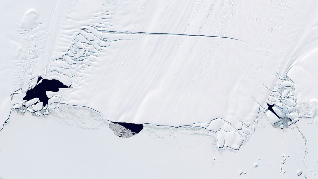
Where is the Thwaites Glacier and how close is it to the Pine Island Glacier?
The Thwaites and Pine Island Glaciers are neighbouring glaciers located on the northernmost margin of the West Antarctic Ice Sheet (WAIS), bordering the Amundsen Sea. They flow into the same body of water, Pine Island Bay. But whereas Pine Island glacier flows almost directly from east to west, the Thwaites Glacier flows from south to north. They are almost at a right angle to each other.
Why do these glaciers matter?
Both of them are of great interest because almost any map of the continent of Antarctica highlights these two areas as regions which have experienced very rapid mass loss over the instrumental record - say the last ten to fifteen years.
Taken together, their catchment area represents about a third of West Antarctica. But because this is a very remote region, scientists haven’t been monitoring it as closely as they have other parts of the continent. Having said that, satellites have been passing overhead intermittently since the 1970s, and very regularly during the last decade. What they show is a very dramatic, sobering, and almost scary amount of mass loss.
How do the Thwaites and Pine Island Glaciers compare in volume?
It depends on how you look at it, but the Thwaites Glacier is perhaps bigger by as much as a factor of two.
What is the Thwaites Glacier telling us about the history and future evolution of the West Antarctic Ice Sheet?
Until recently, the mass loss from the Thwaites Glacier through melting and calving was balanced by the amount of snowfall on the glacier surface. In other words, the amount of water that the glacier removed from the ocean and added to the ocean came to a net figure of zero.
However, over the last decade, or perhaps over the last few decades, that balance has been shifted so that now the amount of mass lost from melting and calving is greater than the amount of mass that is being added. So it is currently losing volume and contributing to sea level rise.
You mentioned that the instrumental records go back just over a decade, but do we have any indication of what may have happened before that?
Yes, we do. Geologists have been looking at the rock record along the walls of the neighbouring mountains to determine the level of ice in the past, or the size of the glacier in terms of depth. It’s a very spotty record, and it certainly does not have the precision or the accuracy of simply going out and measuring contemporary ice with our modern tools, but they are very good at giving us some idea of what the glacier looked like one to three thousand years ago.
And is it showing signs of being a very dynamic glacier in terms of its size and mass balance?
Dynamic has different meanings for different people. All glaciers are dynamic in the sense that they are all moving. The question is whether this extra mass loss (and it is extra mass loss) is due to recent anthropogenic effects? Will the glacier now stabilize at a new steady state, or will it continue to accelerate? It’s clearly a very important question, and one that we’re trying to address.
With the answer to this question still pending, why do you think this particular glacier is so susceptible to change?
One of the reasons is that the Thwaites Glacier is grounded deeper and deeper below sea level as you get further from the ocean. This is a well-known source of instability for glaciers. In this kind of geometry, when the line between the glacier and the ocean starts to retreat landwards, it can no longer remain stable. The danger is that it could start to retreat by hundreds or thousands of kilometers, and do so very, very rapidly in glaciology terms - anywhere from a few hundred years to at most one thousand to two thousand years.
In addition, the Thwaites Glacier flows almost directly into the ocean along the Amundsen Sea coast, whereas a lot of other glaciers in Western Antarctica flow either into the Filchner-Ronne Ice Shelf or into the Ross Ice Shelf. These glaciers are not in direct contact with the ocean and are thus shielded from any changes in oceanic temperature and circulation, whereas any changes in ocean temperature or circulation affects the Thwaites and the Pine Island Glaciers directly through the interaction of warmer oceanic currents and their own ice shelves.
So the Thwaites Glacier also has an ice shelf?
Yes it does, but it’s a very small shelf. It’s nothing like the Filchner-Ronne and Ross Ice Shelves. It used to have a much bigger one a decade or two ago, but it doesn’t seem like it’s a very stable situation. It flows out into something of an open embayment with very deep water, and it seems to break up almost instantly.
Can you tell us about the development of Unmanned Aerial Vehicles (UAVs) to help with your research?
One of the best instruments we have to study glaciers is radar, but to fly it is quite expensive because of the associated costs of planes and pilots. So the idea was to build a UAV very similar to the military drones that you have probably heard about in the news, but in this instance designed solely for the purpose of carrying radar systems. It’s being flight tested even as we speak.
Who is behind this project?
CReSIS, the Center for Remote Sensing of Ice Sheets at the University of Kansas. We have five more years of funding and perhaps as soon as next year, or maybe the year after, we hope to actually put it into production and have one, two, or even more of them flying. They are not meant to be too expensive to produce.
This could revolutionize your field of research…
Yes, it really could, because the range is much larger than human pilots, who can only do ten hours of flying per day. And there is no need for all the instruments and electronics necessary for manned flight, or the weight that these add to the aircraft.
UAVs are effectively a fuel tank and a radar system - that’s it. The sole purpose of UAVs is to move the weight of the radar through the air at around 200km per hour. They can have much longer endurance (as much as 24 hours perhaps).
But of course, as anybody will tell you, once you press a button and let it go things start to happen… So it’s all a very glorious new world, and I’ll personally believe it when I see it!

Sridhar Anandakrishnan
Dr. Sridhar Anandakrishnan is a leading expert on the ice streams of West Antarctica, in particular the Thwaites glacier and other fast-flowing glaciers responsible for draining the interior of the ice sheet. As Professor at the Department of Geosciences at Pennsylvania State University working closely with CReSIS, the Center for the Remote Sensing of Ice Sheets at Kansas State University, he is working to better understand and predict the critical role of polar ice sheets in sea level change using new technologies and computer models.